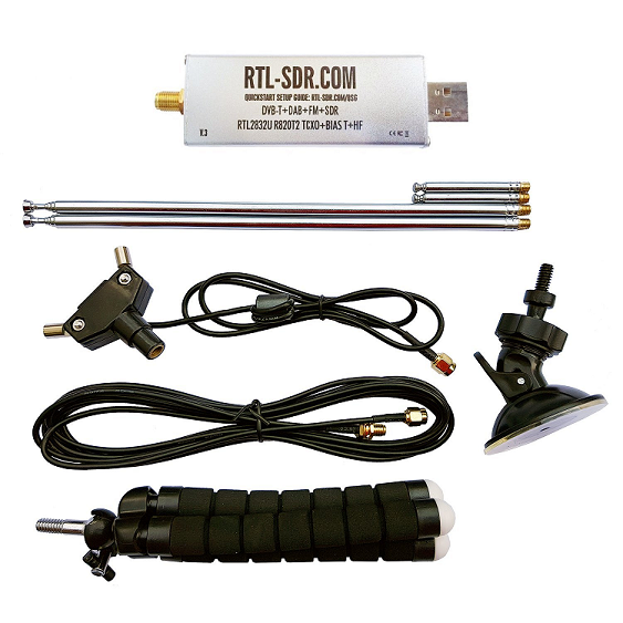
Recently I purchased a Software Defined Radio dongle kit to experiment with. The kit included the SDR dongle, a dipole antenna kit and a small tripod. Through the use of a few open source and freeware programs, I was able to predict, locate, track and record Automatic Picture Transmission broadcast from the NOAA 19 weather satellite. This topic has been written about extensively and many exceptional tutorials exist; however I decided to document my first experiences with SDR and satellite communications.
My procedure below was based primarily on two excellent tutorials on RTL-SDR. If I mention a tutorial below, I'm referring to one of the following:
Receiving NOAA Weather Satellite Images
Simple NOAA Weather Satellite Antenna
I purchased a basic SDR kit through Amazon (link live at the time of writing). The kit included the SDR dongle, a bipole antenna, and a small tripod.
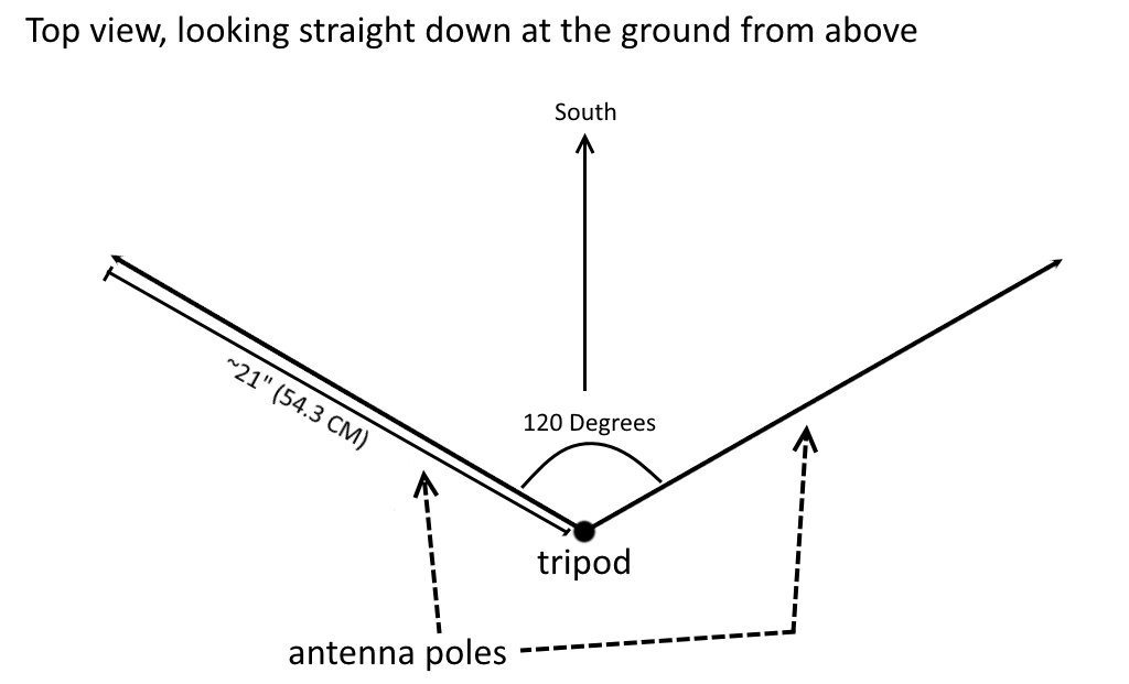
I followed a tutorial for orienting the antenna in a simple bipole "V", roughly tuned to the desired 137 MHz frequency the NOAA satellites use. I printed the template below and used it to align the antenna, and I used a tape measure to roughly set the length of the extendable poles.
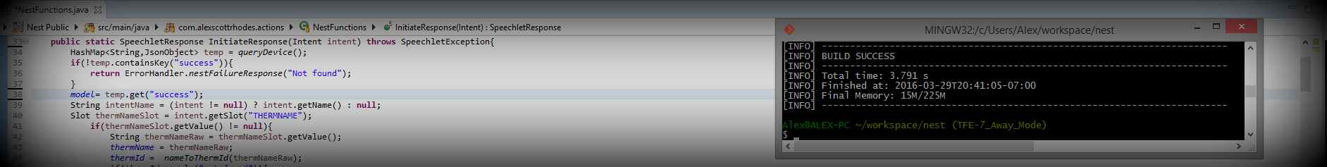
I used a variety of open source and freeware software for this procedure. The required software, its configuration, and its use is documented extensively (including in the tutorials above) so I will just stick with a broad overview.
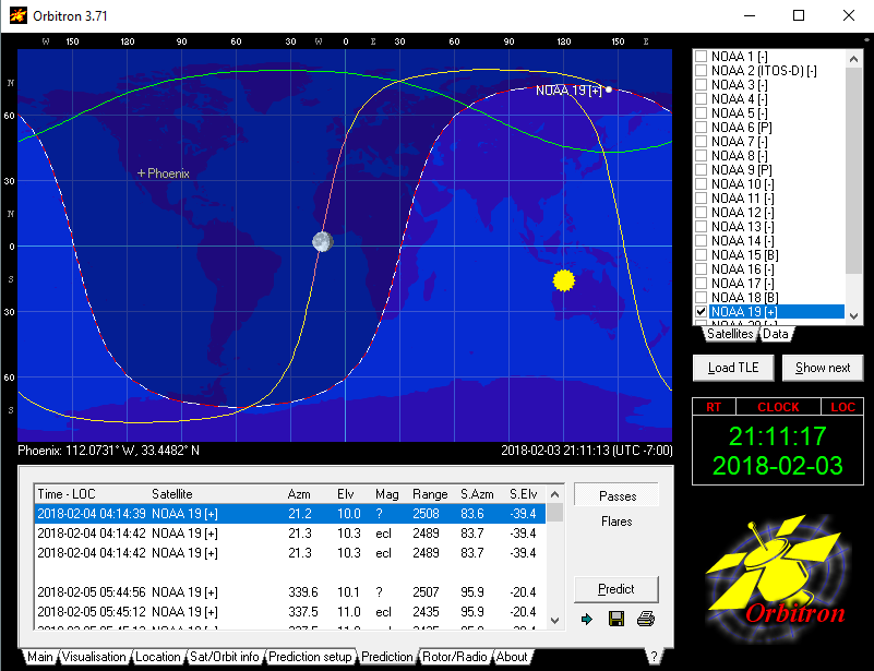
The first piece of software is Orbitron. It is used for tracking and predicting the next pass of a given satellite. It can also be used to feed this positioning information into the SDR Sharp software (see below) in the form of frequency adjustments to compensate for the doppler effect. However, I did not use this feature; rather I manually adjusted the frequency when it began to drift. Orbitron allows a user to set his or her location and then perform a prediction simulation to produce a list of upcoming satellite passes that he or she may attempt to record.
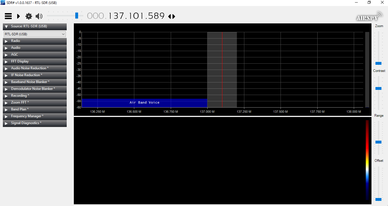
Once on-site at a chosen flyover time, with the antenna set up, the next step is to tune the SDR to the satellite frequency. The software I used is SDR Sharp. SDR Sharp pipes the audio signal output to the decoding application (below) via a utility called Virtual Cable
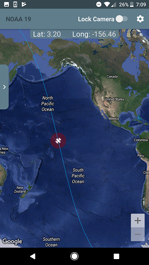
While waiting for the flyover, I used a free Android application on my phone to track the position of the satellite in real time. The app is called Satellite Tracker. It was exciting to see the satellite come into range on the application just as the signal appeared in SDR Sharp.
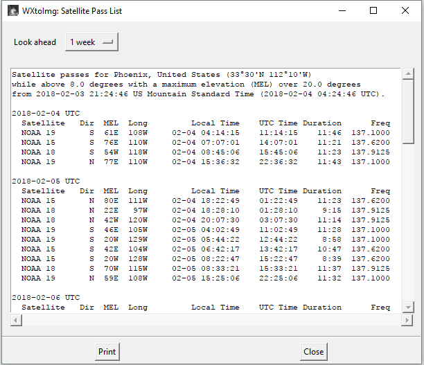
The output end of the Virtual Cable pipe is set as the input to a decoding program called WxToImg. WxToImg provides a feature that produces a "pass list". The pass list has the time and date of upcoming passes and frequency information for satellites it is capable of decoding. I found this to be extremely useful.
WxToImg provides the option to automatically record the upcoming pass when it detects the APT signal on the audio input. When this recording starts the data received is displayed in real time. The video below shows this process along with the audio that was received.
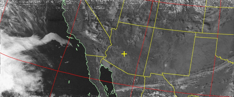
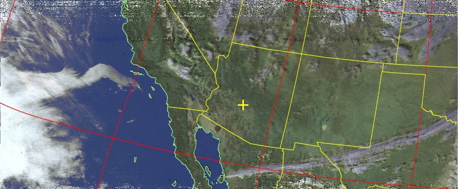
WxToImg provides a set of filters and post-recording processes to produce colorized images and overlays based on data from the NOAA satellite.
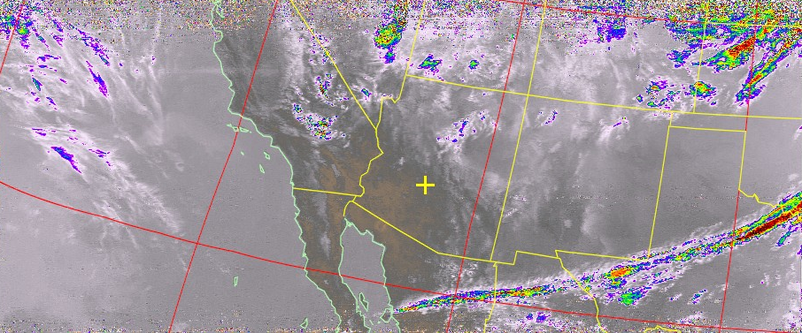
I had a wonderful time learning about Software Defined Radio and radio concepts and terms in general. This was a very enjoyable weekend project and I look forward to doing more with this SDR setup. The images below are from the NOAA 19 satellite.
NOAA 19 Altitude: 807 KM (540.5 MI) Speed: 7,420 M/s (16,598 MPH) Frequency: 137.1 MHz
Contrast:
HVCT Temperature based coloring:
HVCT Precipatation based coloring: